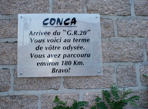
Bavella to Conca
Stage profile
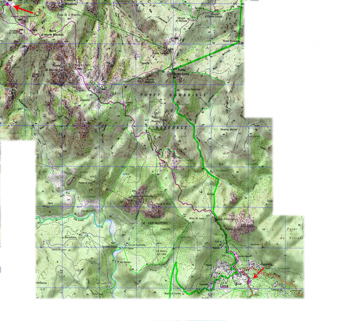
Comment on the stage (north to south)
From Bavella, the road drops down from the col to the lower gite where there is a good spring. You head off through the pine trees and make your way up to the col, called Foce Finosa. A scenic trail will lead you to the small refuge of Paliri. It is well forested but with some steep and rugged bits. From Paliri onwards, it gets a lot more open and a lot hotter as you get to the lower slopes. This is the last stage and it’s mostly downhill all the way!
Changing vegetation as you come out of the mountains. Granite rock gives way to sandy paths, the maquis is higher, lusher and greener in these lower zones. You will pass by the Capeddu ruines and Bocca d’Usciolu, finishing up at 252m in the sleepy village of Conca.